


 Reply With Quote
Where's that?
 Hall Of Fame
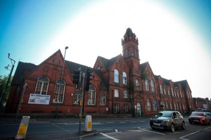
Another historic building being bludgeoned in to dust! - What will replace it? - who knows but will probably an ugly building destined to become student accommodation. Just seems a shame to lose buildings that have links to the past, my parents went to that school back in the 1920’s. Sold off by the Council trying to scrape pennies together to help offset their incompetence, makes me FUME!!!!!!
Hall Of Fame
Where's that?
Hall Of Fame
Radford. Last used as Radford Community Centre. Surplus to requirements apparently!Originally Posted by Robertomac

Hall Of Fame
Was it Benidict Primary School before that?
 Hall Of Fame
I notice that the receivers were officially called in to 'Robin Hood Energy' on the 6th Jan. Only cost the council 50 mill of taxpayers money. They're ob skint.
Hall Of Fame
Is it a Fothergill building? The brick colour and turret looks like the style, but then if it was I would expect it to be listed. Looks too good to knock down anyway.
Are the Notts Civic Society involved at all in trying to protect it?
 Hall Of Fame
Its a decent size on the corner of a major junction on Ilkeston Road/Gregory Boulevard. Two thirds of Ilkeston Road has been redeveloped, mainly for student living so if it does get flattened I could see another Lidl going up. Real shame because it is a lovely old building, a proper old school house. The other option is maintain the external structure and redevelop as posh apartments . . . unfortunately not the best area for that.
 Hall Of Fame
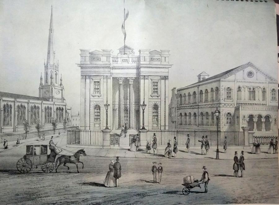
It galls me to think of what was destroyed in this picture, taken opposite of what is now the clock tower entrance to Victoria Shopping centre on Milton St, c1850
 Hall Of Fame
It could have been worse.
The link below is a 1965 plan for a motorway inner ring road.
http://www.ng-spaces.org.uk/wp-conte...compressed.jpg
Hall Of Fame
Not Gregory Boulevard
It's where Radford/Lenton Boulevard crosses Ilkeston Road
Used to be called "Ation Corner".....Damnation = Public House.....Ruination = Pawn Shop.....Education = School....Salvation = Church.
These on each of the four corners.
 Posting Permissions